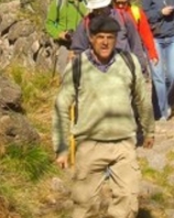
Cangosta is an overused word in Braga archaism, that narrow footpath with irregular and dirt track or not, at the periphery of a village, between walls and hedgerows badly built, clinging by wild coating weeds and plants .This is the main theme of this hiking trail, which can cover much of small and interesting cangostas, which were recovered and reclaimed, as brands and witness of other times.
Data Sheet
Sponsor:Município de Esposende
Route location:Esposende; Antas, S. Paio plateau
Route type: short, circular
Route scope:Historic, landscape and natural
Ponint of departure::Picnic area of Azevedo, in Antas
Point of arrival: Picnic área of Azevedo, in Antas
Length of route :11,70km
Time required:4h30m
Level of difficulty: Easy
Minimum elevation:39m (Peneirada)
Maximum elevation:222m (Bouça de Vila Nova - Caixa d´Água)
points of interest:Menir of Antas, S. Paio de Antas parish church, cruzeiro da Igreja, Inscrição Medieval da Igreja de Antas, Mamoa de Soleimas, Quinta de Filipe, Paul das Feiticeiras, Fonte da Barrugueira, Calçada da Oliveira, pé de cruzeiro da Capela de N.ª Sr.ª da Agra, Capela de N.ª Sr.ª dos Remédios, Quinta de Belinho, cruzeiro e capela de N.ª Sr.ª do Rosário, Alminhas da Quinta de Belinho e Suvidade de Belinho.
Recommended time of year:all year round
cartography: Carta Militar de Portugal - Instituto Geográfico do Exército, escala de 1:25 000, nº 54.
Material needed/ recommended: hiking boots, clothes suitable for hiking and in accordance with the weather at the time, hat, sunglasses and sun cream
Location: Esposende
