From the top of the Labruja Mountain, the Caminho – trail – penetrates deep into a pine, eucalyptus and oak forest. The trail takes us along dirt tracks surrounded by thick patches of trees and various spontaneous vegetation along its borders, mostly ferns. In-between the rocks we can find popular medicinal plants: erva de S. Roberto (for stomach problems); agrimony, or herva hepática (for liver problems), purple foxglove or troques (good for the heart); the diuretic dandelion, chamomile, for spasms and insomnia, among others.
The first houses we find are in Cabanas.
Once we cross the Codeceira River, the cobbled road takes us to the parish church and, in the far end, the Casa do Outeiro. Then we turn to the right and some meters ahead we find, on the tarmac road, a sign pointing to a hostel about 2,000 m ahead. If we turn to the left onto a narrow pathway, which sometimes is quite muddy, and then walk up a cobbled road we will walk by a niche-stone cross of S. Paio, built in 2000 and covered with small stones left by the pilgrims in witness of their travel. The reason for the homage to S. Paio has to do with the old-time belief of the people of Agualonga according to which the patron saint of the parish chose this place to rest during his travels.
After crossing the EN301, the Caminho takes you to the S. Roque Chapel, across the forest of Monte da Costa, then down to Rubiães. The Romanesque church in the background stands next to an old stone cross covered with little stones left by the pilgrims. Once you reach the CM1073, stop to visit the Rubiães Church. Return to the previous landmark and walk about 250 m along the CM1073 before turning left down a dirt track where an old section of the Roman road once stood (road XIX-Braga to Astorga). On the left you will find the Albergue dos Peregrinos, a hostel for pilgrims housed in the old primary school of Rubiães, designed by architect Adão Bermudes.
Cross the EN201 and walk down about 150 m, then turn left to a paved pathway leading to the Peorada Bridge over the Coura River. The margins are covered in thick vegetation (willows, alders, among others), home to a variety of birds. This is also an important water resource, rich in trout, where you can sometimes see the hiding otter. The route again takes us along a wide footpath leading to the EN201 in front of a coffee shop. On the left of this shop, you will find a typical Portuguese cobble-stoned road, taking us across Fuselhas, where the Coura River forms a waterfall and irrigation channels. Continue along a wide cobble-stoned footpath with fields and meadows on the right and riparian woodlands in the far end bordering the Coura River.
After a bend in the road the Caminho continues along a cobbled track bordered on the right by a low dry stone wall framed by spontaneous vegetation. After another twist and turn, the cobbled track begins to climb until it reaches the EN201, and 300 m ahead it meets the CM 1064 that takes you to Bolência. Along this road for about 500 m and then turn left along the road crossing the Couto das Cabras, and Pecene. Not too far from here, to the west, you will see the Monte do Forte da Cidade, where the fortified settlement of Cossourado stands at 368 m high on the hill. While walking along the municipal road, see on the right the shrines in granite embedded in a wall, and a little further ahead, on the left, the chapel of Senhora do Alívio.
Location: Paredes de Coura
The first houses we find are in Cabanas.
Once we cross the Codeceira River, the cobbled road takes us to the parish church and, in the far end, the Casa do Outeiro. Then we turn to the right and some meters ahead we find, on the tarmac road, a sign pointing to a hostel about 2,000 m ahead. If we turn to the left onto a narrow pathway, which sometimes is quite muddy, and then walk up a cobbled road we will walk by a niche-stone cross of S. Paio, built in 2000 and covered with small stones left by the pilgrims in witness of their travel. The reason for the homage to S. Paio has to do with the old-time belief of the people of Agualonga according to which the patron saint of the parish chose this place to rest during his travels.
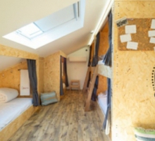
After crossing the EN301, the Caminho takes you to the S. Roque Chapel, across the forest of Monte da Costa, then down to Rubiães. The Romanesque church in the background stands next to an old stone cross covered with little stones left by the pilgrims. Once you reach the CM1073, stop to visit the Rubiães Church. Return to the previous landmark and walk about 250 m along the CM1073 before turning left down a dirt track where an old section of the Roman road once stood (road XIX-Braga to Astorga). On the left you will find the Albergue dos Peregrinos, a hostel for pilgrims housed in the old primary school of Rubiães, designed by architect Adão Bermudes.
Cross the EN201 and walk down about 150 m, then turn left to a paved pathway leading to the Peorada Bridge over the Coura River. The margins are covered in thick vegetation (willows, alders, among others), home to a variety of birds. This is also an important water resource, rich in trout, where you can sometimes see the hiding otter. The route again takes us along a wide footpath leading to the EN201 in front of a coffee shop. On the left of this shop, you will find a typical Portuguese cobble-stoned road, taking us across Fuselhas, where the Coura River forms a waterfall and irrigation channels. Continue along a wide cobble-stoned footpath with fields and meadows on the right and riparian woodlands in the far end bordering the Coura River.
After a bend in the road the Caminho continues along a cobbled track bordered on the right by a low dry stone wall framed by spontaneous vegetation. After another twist and turn, the cobbled track begins to climb until it reaches the EN201, and 300 m ahead it meets the CM 1064 that takes you to Bolência. Along this road for about 500 m and then turn left along the road crossing the Couto das Cabras, and Pecene. Not too far from here, to the west, you will see the Monte do Forte da Cidade, where the fortified settlement of Cossourado stands at 368 m high on the hill. While walking along the municipal road, see on the right the shrines in granite embedded in a wall, and a little further ahead, on the left, the chapel of Senhora do Alívio.
Location: Paredes de Coura